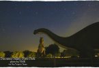
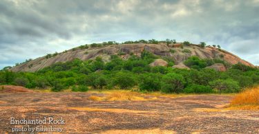
Enchanted Rock is an enormous pink granite pluton rock formation located in the Llano Uplift approximately 15 miles north of Fredericksburg in the...
Texas covers 267,339 square miles, or 7.4% of the nation’s total area. That means that we have a LOT of places to see. We have beaches and deserts, mountains and plains, historic forts and really old churches, and lots of whimsical roadside attractions.
So if you're looking for somewhere to go, something to do or some place new to see, we can help you find it.
Enchanted Rock is an enormous pink granite pluton rock formation located in the Llano Uplift approximately 15 miles north of Fredericksburg in the...
Stonewall is on the Pedernales River thirteen miles east of Fredericksburg in southeastern Gillespie County. The town was named after Confederate...
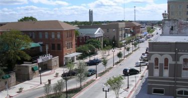
Bryan-College Station, a community rich in tradition and history, set deep in the heart of Central Texas. Bryan, the county seat of Brazos County, is...
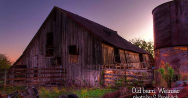
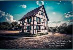
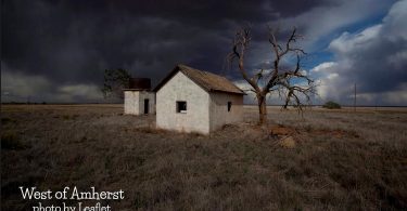
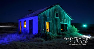
The barn was old when I was young – as far as I know it was built before the war. Its really showing its age these days, but I dare say it is...
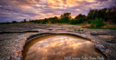
McKinney Falls State Park located in South Austin is a 726-acre park acquired in 1970 from private donation and was opened to the public in 1976. The...
Giddings, county seat of Lee County, is on U.S. highways 290 and 77, fifty-five miles east of Austin and 100 miles west of Houston. The land was...
The BEST Texas sunrises? Well, that's not exactly true because there are just so many more than 15 of them.
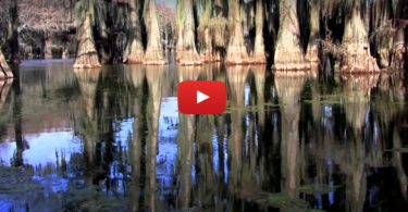
Caddo Lake is the largest Cypress Forest in the world.
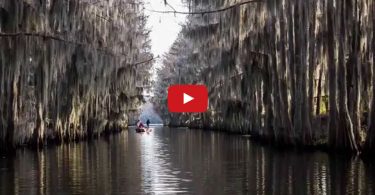
Dallas Camera Club field trip sideshow from Caddo Lake. Awesome images!

A quick look at how the beautiful Azalea Trail event got started in Tyler.
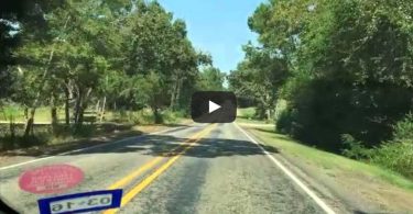
I had to get out of the city, and discover a bit of East Texas...
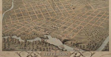
Welcome to the City of Jefferson… "Riverport to the Southwest". Settle in for a journey through time when the living was easy and the era was golden.
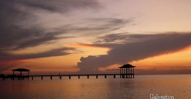
Named after Bernardo de Gálvez y Madrid, Count of Gálvez, Galveston’s first European settlements on the island were constructed around 1816 by...
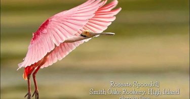
Smith Oaks is 143 acres of field, woods, wetlands and ponds. Thirty-three acres were purchased by HAS wit the help of HAS members, friends, and the...
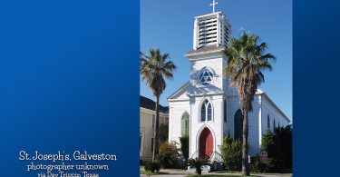
St. Joseph’s in Galveston is a deconsecrated historic church building managed as a community and historic resource by GHF. The oldest German...
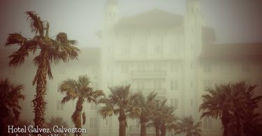
Galveston civic leaders planned on building the Hotel Galvez in 1898 after a fire destroyed another large hotel (the Beach Hotel) on Galveston Island...
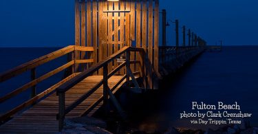
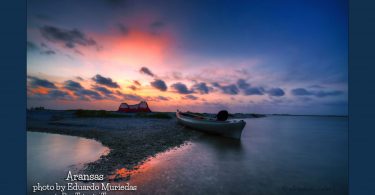
Fulton is a town in Aransas County. As of the 2010 census, this South Texas coastal fishing community had a population of 1,358. The town is named...
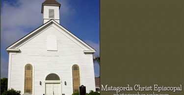
Matagorda Christ Episcopal Church, the oldest Episcopal Church in Texas, traces its history to 1838. The year the Rev. Caleb S. Ives was appointed...
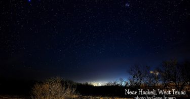
Haskell, the county seat of Haskell County, is at the junction of U.S. Highways 277 and 380 in the central part of the county. It was once on the...
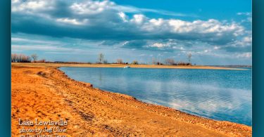
Lake Lewisville is a reservoir located in North Texas (USA) on the Elm Fork of the Trinity River in Denton County near Lewisville. Originally...
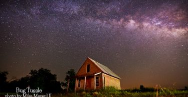
Bug Tussle is at the junction of Farm Road 1550 and State Highway 34, ten miles south of Honey Grove and five miles north of Ladonia in southeastern...
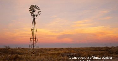
Photo by Mike Mezeul II

An aerial tour of the exterior of the Baker Hotel in Mineral Wells.
The BEST Texas sunrises? Well, that's not exactly true because there are just so many more than 15 of them.
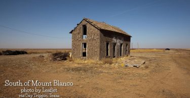
Mount Blanco is on the Caprock escarpment off Farm Road 193 fifty-five miles northeast of Lubbock in northern Crosby County. It was named for a...
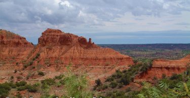
View of Caprock Canyons from Haynes Ridge, Briscoe County. Caprock Canyons State Park and Trailway is a Texas state park located along the eastern...
Love this sky! If you look closely above the horizon on the right side, you’ll see a flock of birds — geese, maybe — and they trail...
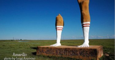
Just off the highway heading south on I-27 out of Amarillo are two gigantic legs in athletic socks. You wouldn't know it, but they are the shattered...
Lorem ipsum dolor sit amet, consectetur adipiscing elit. Sed gravida libero ut erat ullamcorper aliquam. Nam nec nisi eu dui viverra commodo ac in...
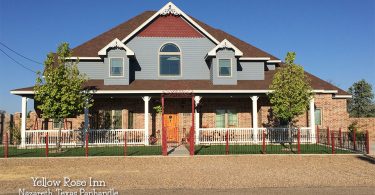
Enjoy an old country breakfast in a Victorian style inn. Relax at your own pace and dream of a simpler life. Visit with local people and the...
It's a wonderful time to visit Del Rio and its sister city in Mexico, where holiday bargains and natural beauty abound.
The community is notable as the place where "Judge" Roy Bean, the "Law West of the Pecos", had his saloon and practiced a kind of law.
Crystal City is in Zavala County. It was originally settled by American farmers and ranchers producing cattle and various crops. Crystal City was a...
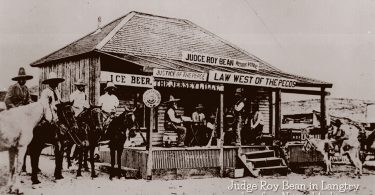
The community is notable as the place where "Judge" Roy Bean, the "Law West of the Pecos", had his saloon and practiced a kind of law.
The BEST Texas sunrises? Well, that's not exactly true because there are just so many more than 15 of them.
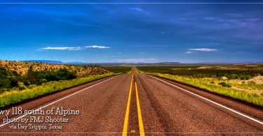
State Highway 118, or SH 118, is a 155.3-mile state highway in the U.S. state of Texas that runs from Big Bend National Park north to Kent and passes...
If you find yourself in Marfa looking for an interesting place to stay, check out El Cosmico. It's an out of this world stop on The Texas Bucket List...
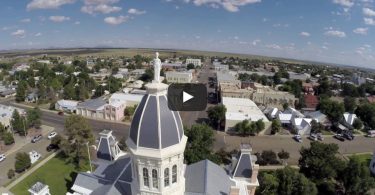
A look at Marfa, Texas and the Presidio County Courthouse in the Big Bend Region of Texas.
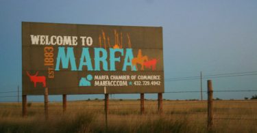
Marfa is a city in the high desert of the Trans-Pecos in far West Texas, located between the Davis Mountains and Big Bend National Park. It is the...
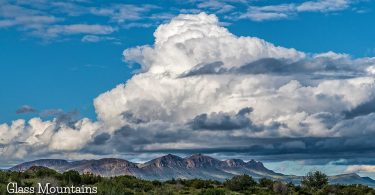
The Glass Mountains in West Texas extend from Cathedral Mountain in northern Brewster County to Monument Draw in southern Pecos County, roughly...
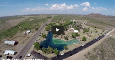
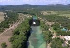
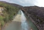
A look at a couple of the water holes in Balmorhea.